10 March 2008

Baw Baw – Walhalla

By Scott

On Friday the 7th March at 5:30 Colin, Gareth, Angus and myself met at the Yinnar Scout Hall. Where we all piled into Mr. Halls ute, on our way to Mt. Baw Baw. Along the way we stopped at Moe McDonalds for a quick dinner. And shortly after that left to continue to Mt Baw Baw car park where we arrived at 7:40. After 20 minutes of discussion we started walking through the little village to find Village Trail. We came to a spot, just after the town where there was a snow blower, and Village Trail, so we followed that until we found an alright campsite. There were tables, trees, Pete Bogs and it was fairly open and very soft, squishy grass. Marked by a wooden sign saying ‘20’. After setting our tents up, and having a little talk we went turned the lights out at about 10:00.

Saturday morning we got up at 7:00 and packed our bags and had breakfast then left camp at 8:27. Walking along Village Trail there’s an intersection where we turned left. Once we turned we could see Loy Yang and Yallourn Power Station to the right. Walking a little bit more we came to an intersection where we turned right which brought us to another intersection where we go straight ahead. At 8:42 we came to a boggy swamp like area that was very open, with a sign post to the left. At 8:45 we had a 4 minute rest to remove our jackets and to have a little breather. And as we started walking we soon came to Pudding Basin. Then the track was a bit overgrown at 8:55 and at 9:00 there was a sign to the left. 9:05 came and there was a sign to the left where we went straight ahead. There was a wooden bridge at 9:13 where we went straight ahead.

At 9:21 we came to an intersection. Left is Mt. Baw Baw – 2.3km. Right (The way we came) leads to Mt. Baw Baw – 2.5km Straight ahead is a narrow hiking trail only that leads to Mt. St. Phillack. Our next rest was at 9:28 at a grassy venue on the side of the track with a nice log to sit on. Surrounded by small gums and 1m-1.5m high shrubs. At 9:28 we started walking again. At 9:40 we came to an open flat with the Tanjil Creek running through it. Which is safe drinking water. And within 1 minute later we met a wooden sign to the left. And another minute later we were walking along a narrow track uphill. 10:00 came and we decided to have an 8 minute rest on the right side of the track. Where there was no grass, small bushes and was rocky. Shortly after that rest we came o an intersection where Mt. Whitelaw was to the left and Mt. St. Phillack was to the right – we turned right.

St. Phillack saddle was open, grassy, windy and had a nice view. 5 minutes later we left St. Phillack saddle and came across an alright campsite that had no water. and another 5 minutes later came across what would make again, an alright campsite with no water. At 10:28 we came to a sign that said ‘Mt. St. Phillack – 1556m’. Nearby was a rock cairn and large rocks. We stopped there for about 13 minutes. When we started walking again we came to a wooden sign to the left. ‘Baw Baw Village – 5km. Mt. St. Gwinear – 1km’ it said. We came across what would be a nice campsite if it had water at 11:09 that was grassy and bushy. At 11:19 there was head height bushes and possibly safe drinking water. We also met a St. Joseph’s school group. Then had a 14 minute break at 11:32 on the side of the track where it was sheltered and had small bushes and sticks on the track. At 11:54 there was an open plane to the right which was grassy.

We stopped for lunch at 12:08. We stopped upon a large rock that was part of the track. There was no grass, and only a few bushes. We started walking again at 12:47 when Angus had realised after Colin strapped up his foot, he’d put the wrong shoes on the wrong feet. After a bit of walking we came across what, again would be a nice campsite but had no water. And 4 minutes later another one amongst a rather large clearing. At 1:20, after 15 minutes of walking we met two hikers who said it was only 50 minutes to Mt. Erica. After talking to them we had a quick 13 minute rest on the side of the track. Sitting on a large rock we declared the track was getting steeper.

Once we got to the top of Mt. Talbot and over the peak. We came across an old, large, stone and mortar fire place and chimney that was about 2 metres tall standing among same rocks and logs. There was a track from this ruin towards the creek, which went nowhere. it must be a track people use regularly when camping in this area. It would of been a good campsite with water.

To get back on track we had to back-track a little bit to a path with 2 small wooden bridges crossing Hut Creek. We stopped here at 2:45 and restocked our water supplies. As we were about to leave we met some walkers walking to the ruin for a day trip, and we got talking to them for a while and left at 3:00. At 3:00 we started walking up the slopes of Mt. Erica and at 3:10 came to a wooden sign that said ‘Mt. Erica 1509’ where we had a photo opportunity. At 3:40 we met three more hikers and at 3:45 had a small break where the day-trippers walked passed us. And at 3:50 we got walking again.

At 4:30 we had a 5 minute rest on the side of the track. And at 4:58 came to a little creek of possibly safe drinking water to the right of the track about 100 metres below of the car park. We came walking into the car park at about 5:00. Where we stopped and sat on a table near an information board. Where we got talking to some hikers walking into The Rocks and shared some information with them. We then decided we needed to start getting into camp and started walking along the road to an intersection. Straight ahead leads to Monarchs walk and left was Mt. Erica road. We turned left. About 15 minutes after the intersection we called a 5 minute rest on the side of the road. Then walked to where the trail continued. This is what we called our campsite for Saturday night and we arrived at about 6:00. It was a little opening, with a silver Nissan parked in it. About 75 metres away from a good water source.

As we started putting the tents up we realised the ground wasn’t too soft after about 5cm of small clay clumps with a thin layer of grass growing on top, but it was too late to do anything about it, so we found a rock and tree root and used them as hammers to hit the pegs in, and they turned out hanging in there. At the point of the campsite we were 16km away from Walhalla. As Colin had arranged earlier, Katrina was dropping Caitlin off at this opening. So we lit a small signal fire to make it easier to be seen. When Katrina came Caitlin’s luggage was unloaded and Angus’s was loaded in. We’d decided Angus, after rolling his ankle, had had enough and was going to go home. So at 10:45, after 5 minutes of her being there, Katrina left. And, after setting up Caitlin’s tent, lights were off at 11:00.

Sunday morning we arose at 7:00 again, had breakfast, packed and were ready by 8:15 we had started walking to Walhalla. Just after we started we had a steep decent and there were a few complaints about how this impacted on them. And it could be slippery if it was wet. At 9:37 after a few rests here and there we crossed the creek near O’Shea’s Mill Site. Where there was no bridge, and was slippery. At O’Shea’s Mill Site there was another St. Joseph’s school group walking in the opposite direction to us. And there was a group of people camping there. We stopped here until 10:00. We walked up to the drop dunny and turned right to get back unto the trail. This time the trail was a fairly steep accent and we rested at 10:27 on the side on the track where we all gulped down some water and started walking again at 10:35.

At 10:39 we came to a gate with an Australian Alpine Walking Trail sign on it. And a minute later we we’re crossing a bitumen road – the Thompson Valley Road. To the right of us there was a road called Southface road which goes down to O’Sheas. We crossed and went down Fingerboard Spur which was steeper then what we’d walked that morning. We came to a sharp bend and met some hikers with dogs discussing which way the track went. So we helped them out and they told us they’d seen a snake on the track they’d come along and we were about to go on. So at 11:15 we started walking, keeping our eyes on the watch for this snake, that nobody saw. Also along the spur we saw three other hikers. Then walked along a very poor track for about 30 minutes.

Then the track stopped and we came to a bridge – Poverty Point. This bridge is 40 metres long and 1.8 metres wide. And stands about 12.8 metres above a usual summer flow of the Thompson River below. This spectacular bridge was built in the 1900’s and has new handrails. We stopped here for a short break and at 12:04 we started walking again. And came to a track on the right which we continued to walk past. Then we met 12 walkers over a period of 15 minutes, all going down to look at the Poverty Point Bridge. We stopped at 12:38 for some water from a run off. This water was beautiful to drink and very fresh. And 9 minutes later started walking again.

At 1:11 we stopped for lunch at the top of Killer Hill. Only 4km to Walhalla from here. We dried most of the perspiration from our shirts during our 50 minute lunch break. And after throwing a few rocks, we learnt that the Buda religion believes that everything, every rock and stick has a soul, and that over time, it works hard to get in such a spot with a good view, and by throwing it off, it may take millions of years for it to get back to this spot. So we decided to help the rocks and throw some uphill a bit, to save them the time in waiting.

After 45 minutes of walking the Walhalla Train Station came visible from the trail. And 5 minutes later we could see the Cemetery from the trail. We stopped for a 15 minute rest on the side of the trail at 3:11. And at 3:21 we were walking down the stairs, into Walhalla opposite the general store. We had finished 38kms of walking in 2 days. So after Colin had finished his milkshake we went down to the swimming hole and dipped our feet in the fresh, cool, creek, where Colin cracked his Coke open. Soon after, our transport, Sylvia and Mum arrived and we were on our way home.

13 November 2007

Scout Hike...... One golden hike ........

 
On the 9th – 11th of November (last weekend) 4, scouts went to mount disappointment to participate in the scouthike. We first got private transport to sleep point 4. Our patrol was the first ones in and the first ones out. We planned to do all of the activities. We were going at a fairly fast speed the whole way and overtook a couple of patrols. When some people started to run a couple of people got left behind, but caught up very quickly. On the first day (Saturday) we walked through 13 of the checkpoints, completing them all. We didn’t get to the last checkpoint; Y. unfortunately we didn’t make to the finish sleep point (6) in time to get the 100 bonus points. When we got there in the end we checked in wile, a first aid person had a look at Max’s foot witch was starting to slow us down. That night Max went to bed early without any dinner, the next day was going to be a big day. On Sunday we Got up early and packed, we left 10 minute after 7:00,we were still the first patrol out, we got a free bar for being early. We were the last ones in and the first ones out. The 2nd day wasn’t much faster than the 1st day. We completed 5 activities and arrived at the 6th activity, we had much less time than the second day than the firs. When we were on the poisoned post track we nearly got lost, we went turn off too early it wasn’t marked on the map. The last 2 activities were T and S. We ran to s and completed the activity as fast as we could, then we sprinted, While Gareth went ahead to tell the people from T that we were coming. When we got there we were too late and could only get the travel points. We didn’t think that we did too bad in the competition and we weren’t wrong. When we arrive the finish line we checked in and got 100 points for being in full uniform (Angus borrowed some one else’s scarf from another group). It took a very long time to get the results, we thing that it was because of the person talking to another person. Whit the awards Yinnar go called up to get their gold award, we came 8th out of 57 other patrols. In total we visited 19 out of 24 stations.
The activities had letters for different countries; U was for United Kingdom…N was for New Zealand. They were all based about their countries. The leaders didn’t talk these languages though.


By Caitline

12 September 2007

Gareth's Hike

On the 1st and the 2nd of September Scott, Lachlan, Callum, Caitlin, Max, Angus, Tom, Regan and I went on a hike at Moondarra State Park organized by myself. We were accompanied by Sylvia. We started walking from the intersection of Dwyer Track and Tanjil Bren Road, about 2km down Tanjil Bren Road, in a north westerly direction. After we had hiked about three kilometers we turned east and started hiking along Sennis Track. Along the Sennis Track we came across a group of motorbike riders, so we had to be careful of others using the track. About six kilometres later along the track we came to the Sennis Camping Ground, located on the Tyers River.

When we arrived there we had a short rest before we started setting up our tents.

Sylvia had already started a fire so we went and collected more firewood. We sat round the fire and talked before we started cooking tea. After tea we sat round the fire talking while people went to bed one at a time.

In the morning we packed up and left about five minutes later than what was planned. It was harder on the 2nd day because it was mostly uphill. Max was having difficulty walking because he had hurt his foot the day before but we still finished early. Once we reached to the finish point we had to wait 45 minutes until the transport vehicles arrived.


In my opinion it was a successful hike except for the rubbish problem. It was a good hike because we finished early and it was enjoyable.

10 August 2007

Mt Worth State Park Hike


On the 18th and the 19th of August there was a hike at Mount Worth State Park, near Allambee. We walked 4.8 km the 1st day and 11.2 km the second day. Kรคfa and Akela (Katrina) went for about ½ an hour on the first bit. The whole way on the first bit on the first day was easy; I ended up carrying Kobi’s backpack for about the last 2 km until the camp grounds. Because Nobody was allowed to stay at Mount worth state park over night we had to walk 3 km (included in the working out of kilometres) down the road to an old tennis court area It took a little longer than I had expected to get the tents up but I don’t blame the scouts entirely because they were trying to help get Andrew out of the mud because he was bogged. He ended up walking down the rd for a few kilometres. After everyone got set up at camp we finally got the fire going under wet conditions using my strategy. In the morning it took way too long to get packed up I hope that every one does a better job next time!

When we actually got back into mount worth state park Andrew was walking with us. It was fairly hilly but I didn’t mind, I thought that it wasn’t too bad but a few other scouts were starting to complain a bit that it was getting hard. I thought for a wile (about half way) that we were going the wrong direction. In the end we found out that we were going the rite way and it was just that we were taking too many rests and walking too slow. We completed the 11.2 km track one hour late.

I thought that the hike went fairly well, it would have been better if we were a bit more organised with time. The hills were a good challenge and it was a bit tiering for the younger scouts at the end, they would of slept well.

Thanks for coming Gareth, Angus, Kobi, Tom and Regan

.(I came too.)

12:30 met at Yinnar scout hall to get organised.

2:00: Started walking

5:00: Got to the camp site.

8:30(Morning) Finished off packing up and start walking again.

1:00: Go home time.

By Max

18 May 2007

Callums Bike Hike Report


On the 12th and 13th of May I held a bike hike on the Great Southern Rail Trail. There were 8 people that went: Lachlan, Caitlin, Gareth, Max, Angus, Rory, James and Callum. The leaders that came was Andrew the first day and Craig the second day. We started the bike ride at Leongatha, Caitlin fell off in the first 2 minutes. Just after Koonwarra we had to ride on the highway for 3 km and mum and dad escorted us with the cars. When it got dark we got out our lights. At Meeniyan my derailer snapped right off and dad brought me his bike to ride the rest of the way. A little before we got to Buffalo the pedal fell of my dad’s bike so Andrew smashed it back on with his big pliers. We rode to Buffalo and slept there on the second day we rode from Buffalo to Fish Creek and from there to Foster, on the way back to Fish Creek

Caitlin got some kind of tooth stuck in her tyre which gave her a puncture and it took us 40min to fix, then back to Fish Creek then to Buffalo all ? 70 km. All up I think that it went well apart from a couple of break down delays and when we left in the morning we didn’t leave as early as I would have liked. All the cooking went well and we didn’t forget to get anyth ing. We were a bit late on Sunday getting back to the finish point, thanks to mum for packing up the tents because we were late.

By Callum

25 March 2007

Wilsons Prom Hike


On the 24th of March, Lachlan, Callum, Gareth, Scott, Max, Angus and myself went hiking at Wilsons Prom. We were accompanied by Colin and Jo.

We started hiking at Telegraph Saddle and headed towards our sleeping point, Sealers Cove.

We stopped at a cave that a group of Venturers told us about and decided that we would explore the cave on the next day, because it was raining. We stopped again at the start of the board walk, which is about 2 km long, and put our coats on. When we were about a ¼ of the way along the board walk, a small tree almost fell on Jo.

It continued to rain only easing down when we got to Sealers Cove. It was another 700 metres along the beach to get to the campsite. Getting to the campsite included crossing a river. Luckily it was low tide and we didn’t get much wetter than we already were from the rain.


By the time we had arrived at the campsite the rain had stopped and the sun was coming out.

Once we had our tents up and we had all changed into dry clothes we climbed up to the top of a big rock and put our wet clothes there to dry.

The next morning half of the group crossed the river and went on the beach while we waited for the remaining people to finish packing up. We set off at about 11: 00 am. We stopped every now and again for breaks.

Along the way we met up with Matt and Bryce who walked out from Telegraph Saddle to meet us.

We stopped at the cave for lunch and explored the cave once everyone had finished their lunch. To get into the main part of the cave we had to get though a tunnel that was on a 45˚ angle. In the cave there were these strange 6 legged insects that looked like spiders.

As soon as everyone had finished exploring, we set off hiking again. We stopped to fill up our drink bottles at Fern Tree Gully.

We arrived back at Telegraph Saddle at about 2: 45 pm and arrived back in Boolarra at about 5: 30 pm.

By Caitlin


if you like to know more about the Wilsons Prom see: http://www.parkweb.vic.gov.au/1park_display.cfm?park=217

25 February 2007

Founders Day in Melbourne 24 Feb 2007

See also the Founders Day in Melbourne website

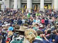
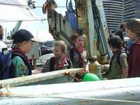
We went to Melbourne by train, we marched around, it was more walking around, then we sat on the steps of parliament and had to listen to people. We did our scout promise again, then we walked to the park and ate lunch then we we split into two groups and did some activities, we saw a giant birthday cake, it had the scout symbol on it and the photo of BP. at one activity we had to hit these blocks that came down a tube, I hit two of them, I wanted to do plaster painting. I did not get it done because anouther scout took off and I had to go. There was a bridge where we liked to go over the same other scout took off again and I had to go and look for him, the rovers gave out free ice with cordial we had to answer questions I was asked what rovers do and I said build cars it was correct. There was a abseiling trailer but this Scouts took off again, there was a water activity with no water you had to go throw a course with a faked canoe which you had to carry, there was food, there was hear dying I wanted to get it dyed it was taking to long to wait for my turn. After we went on a tram and we were allowed to go into the drivers cabin that was in the back of the tram we got off at the dogs and saw the boat that stops wale hunters and gives free tours on the boat we went on the top deck but not on the money deck and one of the scouts spat down into the water and it took a wile until the spit touched the water. The monkey deck is where all the radar is. than we rushed to the train station and went on a fast train but a lady did not let anyone on the toilet as she got off we got on the toilette. two of the carriages where full of scouts. This is the website of the Wale protection boat www.seashepherd.org

By Angus